 |
| 4ELEVEN images' flickr photostream |
My first experience with the tutorials, prior to the VIOLA moment above, was flat. I wasn't seeing the depth of this tool. However, as I worked through the steps outlined in Berger and Trexler and gave screens time to load, the information I had learned in the previous tutorials on the Google Earth site now made more sense. These tutorials are worthwhile (there are Beginner Tutorials, Advanced Tutorials and 3D Tutorials) to get an overview of Google Earth and the navigation throughout the site.
I began with the Sightseeing Tour under My Places tab on the sidebar in Google Earth. This time I gave sites time to load completely (this also means be patient as you zoom in or change perspectives when viewing locations). Perhaps this isn't an issue with faster browsers, but something to be aware of - buffering. As I progressed through the tour I was able to zoom in to see 3D buildings (computer generated), view pictures which have be geotagged to the location, and connect to links identified within the geotagged images (displayed on the tag accompanying the image).
It is very easy to create your own tours (placemarking) and include information (images, links) at specific points. This is demonstrated in the video recommended by Berger and Trexler (p. 200), Google Earth Creating Paths:
I next explored Google Maps. This was something I was aware of and had used multiple times (particularly to find arenas when running my kids to ringette and hockey). I have also created a map to give directions to our house. A great video to take you through these steps is Google Maps Introduction:
The next feature I explored was the Google Oceans. I focused initially on the Titanic in the North Atlantic Ocean. The tour takes you below the surface of the water to where the wreckage lies on the bottom of the ocean. When you click on the placemark, you find a link to the National Geographic site which includes photos, videos, interactive activities and other information relevant to this location on Google Earth. The following video also gives an overview of this feature with other topographical features.
Berger and Trexler also summarize many of the content layers available in the "Ocean" panel (p. 193-194). As they have describe, these include:
- Explore the Ocean - provides an oceans overview in a 7:36 minute video, sponsored by National Geographic Society and narrated by Sylvia Earle.
- National Geographic - contains magazine quiz (bubble with image and ocean facts with a question and answer options to be submitted) and ocean atlas.
- BBC Earth - offers the viewer a tour of ocean places with beautiful images, videos, and additional links.
- Cousteau Ocean World - provides selected videos in pop-up bubbles, with text and links.
- Ocean Sports - features surf, dive, and kite surfing spots, with links to additional photographs and comments by surfers, deep sea divers, and kite surfers.
- Shipwrecks - pinpoints shipwrecks worldwide, providing brief text information in a bubble, with a link leading to more information, including ship name, weight, nationality, place launched, service history, and cause of sinking.
- Ocean Expeditions - takes the viewer on a tour of expeditions, with links to sources of more detailed information.
- Marine Protected Areas - shows protected areas worldwide with stories, facts, links, videos, images, and allows for information to be added by the user. Two such examples are the Great Barrier Reef Park and the Marine Mammal Sanctuary of the Dominican Republic. Areas included are protected for various reasons.
- ARKive: Endangered Ocean Species - contains images or videos of endangered sea life with its status, information about the creature, threats against it, placemark details, and links to more information. This resource can be located under the global awareness layer pane.
- State of the Ocean - feature ocean observations, sea surface temperature, Arctic Sea ice, human impacts, dead zones (marine zones without enough oxygen to sustain life), MBA: Seafood Watch, and MCS: Fish to Eat
- Animal Tracking - indicates tagging information such as tag number, gender, length, weight, animal facts, photo, and swim with me video for Global Tagging of Pelagic Predators program.
- Census of Marine Life - provides statistics and influences on marine life.
- Marine Tharp Historical Map - gives a map of the ocean floor charted by famed oceanographer Marie Tharp; downloadable and viewable; can zoom and pan.
- Underwater Features - pinpoints reefs, troughs, shoals, seamounts, banks, ledges, basins, canyons, holes, and ridges worldwide.
There is also Google Sky, Google Moon,and Google Mars. These sites provide imagery and information that completely supports the grade 6 Sky Science Alberta curriculum.
A quick search through the Educational Gallery will provide numerous other KML or KMZ files which are already made up and ready to be used. There is also the genereal Gallery which includes the Educational Gallery and more.
I did play around with Picasa and geotagging my photos. This was interesting to do. I tagged photos that were taken when we lived at our first home, and then photos from our second home. I also tagged some photographs taken while on vacations at various locations. It was interesting to view the larger picture of where we have travelled and what we have experienced. As indicated in Berger and Trexler, "the benefit of using geotagging is that it provides another means of organizing digital resources and thereby provides better seraching capabilities for such resources at a later date" (p. 181). I can see benefits of this as the number of digital photographs we take and keep increases.
This tool is incredible relevant to inquiry based learning. As Berger and Trexler indicate, it is helpful in engaging students in inquiry based learning (p. 183).
Rather than targeting one phase of the inquiry process, Google Earth helps students to gain a more global perspective. It places imagery and other geographic information on a student's desktop while integrating with multiple curricular areas: it supports practically all the geography standards, several mathematics standards, many of the science standards and technology standards.
Further, Berger and Trexler site Nine Reasons to Use Google Earth (p. 184):
- Provides a wide rang of information in a geographic context.
- Supports inquiry-based activities.
- Applies to studies across the curriculum - history, literature, math, science, and current events.
- Incorporates images, audio, video, and text in maps.
- Enables users to create, display, and share their own data.
- Helps students visualize patterns in their city, state, country, and the world.
- Supports visual literacy.
- Encourages collaboration.
- Supports various learning modalities.
As a parent, I feel these apply to the learning we do at home as well.
Reverting to my example of the novel study I am doing in class, I had previously stated including visuals of the settings used for the story line would have enabled the students to develop a deeper understanding how the setting contributes to the story. Using Google Earth, I could create a Tour for the students to take, including all the necessary "geographical metadata" necessary to "add more depth and meaning to digital resources" the students viewed (Trexler & Berger, p. 181).
 |
| Stash Kulesh's flickr photostream |
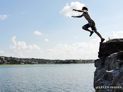
Transformation - I am now using the duct tape to create a bungy cord. This is an exciting tool to leap from the cliffs with!
Resources
Berger, P. & Trexler, S. (2010). Choosing web 2.0 tools for learning and teaching in a digital world. Sanata Barbara, CA: Libraries Unlimited.
Berger, P. & Trexler, S. (2010). Choosing web 2.0 tools for learning and teaching in a digital world. Sanata Barbara, CA: Libraries Unlimited.
No comments:
Post a Comment